 Home
Home E-mail
| Distances Sites (Km) and Geolocation | ||||||||
| Sites | Radar | INPE | Airport | Delta | Anemometric | UEMA | ||
| Radar | - | 1.8 | 5.25 | 7.35 | 6.2 | 37.3 | ||
| INPE | 1.8 | - | 3.9 | 5.85 | 4.7 | 35.5 | ||
| Airport | 5.25 | 3.9 | - | 2.0 | 6.35 | 31.8 | ||
| Delta Village | 7.35 | 5.35 | 2.0 | - | 7.5 | 29.7 | ||
| Anemometric | 6.2 | 4.7 | 6.35 | 7.5 | - | 35.1 | ||
| UEMA | 37.3 | 35.5 | 31.8 | 29.7 | 35.1 | - | ||
| Sites | Latitude | Longitude | Epsoidal High |
| Radar | -02º 19' 48.0" | -44º 25' | 45m |
| INPE | -02º 20' 20.9" | -44º 24' | 49m |
| Airport | -02º 22' 40.8" | -44º 23' | 45m |
| Delta Village | -02º 23' 08.9" | -44º 22' | 34m |
| Anemometric | -02°19’ 08.7” | -44°22’ 03.3” | 48 m |
| UEMA | -02°35’ 35.7” | -44°10’ 43.1” | 65 m |
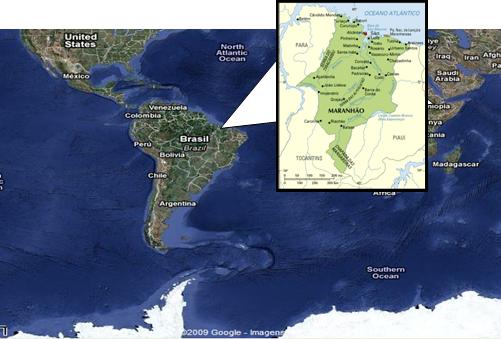
São Luís is the capital of the Brazilian state of Maranhão and is located on São Luís island in the Baía de São Marcos. The city has a population of about 1,000,000 people. Alcântara is 30 km away from São Luís and it is a very small city with a population of about 22,000. Both cities were declared by the Brazilian government as a National Historical Patrimony. The Figure 2.1 shows Alcântara in Maranhão and Brasil.
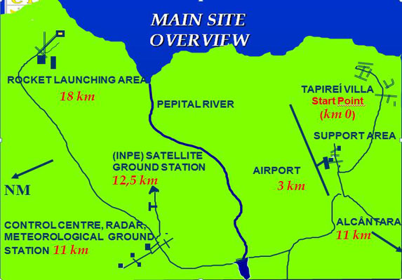
CLA main installation is located at Alcântara, but has also some administrative offices, airplanes hangar and a Rocket Radar site (named Sítio da Raposa) at the São Luís island. The Figure 2.2 shows CLA main installation at Alcântara, the São Luís UEMA site.
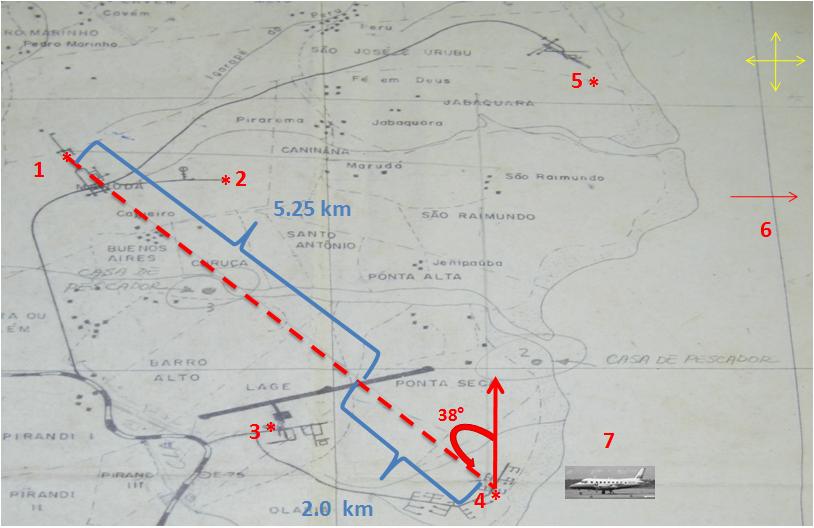
The experiment will be held at the Alcântara Launching Center (CLA), from February 24th to March 25th, 2010. Data collection period will extend from March 1st to 20th. The next figures show road distances (figure 3.1) and some facilities (figure 3.2) at CLA.
Considering local facilities there was some changes in the measuring sites. After some discussions the following sites was chosen:
- SITE 1 RADAR
- SITE 2 INPE Facilities.
- SITE 3 Airport.
- SITE 4 Delta Village.
- SITE 5 Anemometric Tower.
- SITE 6 UEMA.
- SITE 7 UECE Airplane.
- ----------- Main Line of Measurements.